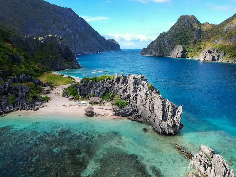
Baja California Sur’s Sea of Cortez shoreline ranges from accessible recreation beaches to undeveloped island coves reached only by boat. There is no single “best” beach: the right choice depends on swimming ability, wind, season, road access and whether you want services or solitude.
Check before setting out
Protected-area rules, road conditions, boat access and daily visitor controls can change. Confirm current requirements locally and never treat an isolated beach as serviced simply because it appears on a map.
- Download directions before leaving mobile coverage
- Carry drinking water, shade and a way to pack out waste
- Check wind, heat, tides and marine forecasts
- Use authorized operators where protected-area rules require them
Choosing a beach
Southern beaches can feel warm and sheltered, but conditions change with wind and tropical weather. Farther north, beaches around La Paz and Loreto often have broad views, clear shallows and exposed approaches. Many locations have no lifeguards, reliable shade, drinking water or waste collection.
Public shoreline access and concessions are governed by Mexican law, but the practical route to a beach may cross controlled land or protected habitat. Respect signs, gates, visitor limits and conservation instructions. Do not remove shells, coral, sand dollars or other natural material.

Cabo Pulmo and the East Cape
Cabo Pulmo
Cabo Pulmo combines an attractive shoreline with access to a protected marine environment. The reef—not beach amenities—is the central reason to visit. Snorkeling and diving should follow current park rules, designated access practices and guidance from authorized local operators where required.
Road conditions on East Cape approaches vary. Build in daylight, carry supplies and avoid assuming that a route suitable in one season will remain unchanged after storms. The coast north toward Los Barriles includes quieter stretches, though services and access differ substantially.
La Ventana and El Sargento
These long beaches are closely associated with winter north winds and wind sports. On calmer days they can suit beach walking and swimming, but wind can rise quickly and push small craft offshore. Development remains lighter than in major resort zones, so bring water, sun protection and a clear return plan.
Beaches around La Paz
Tecolote
Tecolote is the more activity-oriented choice north of La Paz, with seasonal food service, boat outings and broad views toward Espíritu Santo. It can be busy during holidays. Winter wind can roughen the water, while summer may bring heat and limited shade. Confirm the day’s boat and protected-island rules before booking an excursion.
Balandra
Balandra is known for shallow turquoise water, pale sand and distinctive rock formations. Its ecological sensitivity is more important than any ranking. Access controls and permitted activities may change, so verify current visitor arrangements before departure. Remain on appropriate paths, avoid trampling vegetation and do not disturb tidal habitat.
Shallow water is not automatically risk-free. Watch footing, tides and exposure, supervise children closely and carry adequate sun protection. For boating context, review the anchoring restrictions for Bahía Balandra.

Espíritu Santo and island coves
Beaches such as Playa Bonanza are reached by boat and form part of a sensitive island environment. The appeal is their relative wildness: expect little or no infrastructure. Trips depend on wind, authorization and operator arrangements. Read the current usage restrictions for the Espíritu Santo archipelago before planning.
Do not count on mobile service or a quick return if weather changes. A responsible outing includes drinking water, shade, secure waste storage and a conservative marine forecast.
Isla San Francisco
This striking crescent bay lies well north of La Paz and is generally approached by private or chartered boat. Its remoteness makes self-sufficiency essential. Anchorage suitability changes with conditions, and exposed hiking terrain demands sturdy footwear, water and heat awareness.
Agua Verde and the Loreto coast
Agua Verde
Agua Verde is a remote bay valued for clear water, beach walking and its dramatic setting. Overland access can be rough and slow, particularly after weather events. Treat estimated distances cautiously, travel in daylight and confirm the road before committing a vehicle.
Ligüí, Tripuí and Loreto-area beaches
South of Loreto, smaller beaches offer darker sand, island views and a quieter atmosphere than the south. Some approaches are straightforward; others pass near developed properties or concessions. Follow posted access routes and avoid blocking working or residential areas.
Honeymoon Cove
Honeymoon Cove on Isla Danzante is boat-access only and has no ordinary beach services. Its scenery is memorable, but isolation, heat and changing wind matter more than old popularity lists. Arrange transport with a suitable operator and verify camping or landing rules before leaving the mainland.
Water and wildlife safety
Most beaches in this guide should be treated as unguarded. Stingrays may rest in sandy shallows; shuffle your feet rather than taking high steps. Jellyfish and Portuguese man-of-war can appear seasonally. Do not touch stranded marine animals, and leave the water if visibility, wind or current creates doubt.
Reef-safe behavior means never standing on coral, feeding wildlife or pursuing animals for photographs. Keep distance from nesting areas and follow all directions in protected zones. For related activities, see Bojainsider’s eco-travel and diving and snorkeling sections.
Leave the beach better
Pack out everything you bring, including food scraps and pet waste. Bins can overflow or go uncollected in remote areas. Avoid fires and vehicles where prohibited, keep noise low and leave natural objects where you find them.